
| Rain Forest National Park Walks |
Getting there |
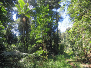
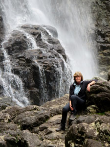
After walking at three different locations along the North Coast of New South Wales, it was perhaps time to go inland .... our destination, Nimbin, still clinging to its reputation as the centre for alternate life-style that made it famous in the 1970s and 80s. Our goal though was the Nightcap National Park, on its north-eastern flank ... part of an ancient volcanic shield and home to Gondwana rainforests, it is now World Heritage listed. This was not always the case ... it took the so-called "rain forest war" from 1979-82, when protesters mobilised to protect this forest from loggers, to finally see the region declared a national park in 1983. Such a place is well worth a visit .... thus we found ourselves driving up a narrow and pot-holey bitumen road into the heart of the Nightcap Range to do a short walk on our way through to Queensland. |
|
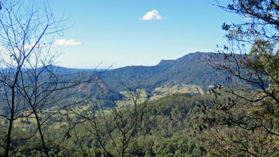
Pholis Gap and Mt Matheson Circuit - Nightcap National Park (6.5 km - 345m ascent - 345m descent) |

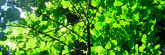
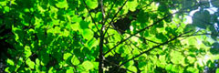
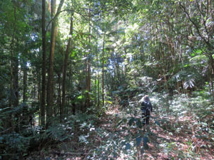
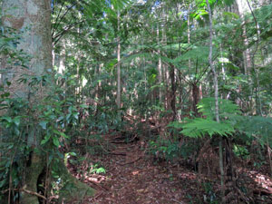
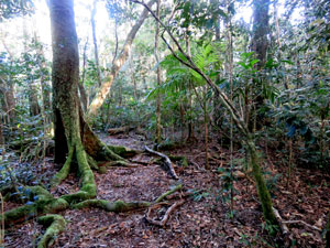
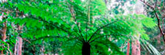
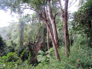
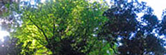
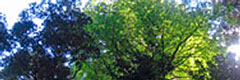
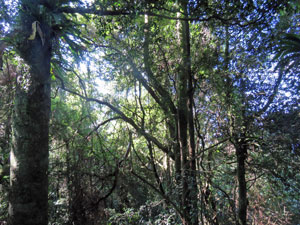
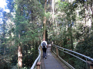
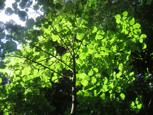
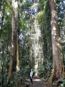
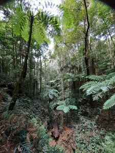
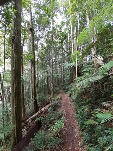
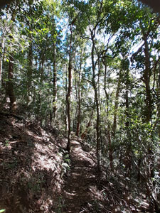
The Pholis Gap track starts on a corner of the road leading up to Mt Nardis, with its twin communication towers .... higher even than the surrounding rainforest trees. However, once we set out on the track beneath the dense and shady rainforest canopy, all signs of civilisation vanished. |
||
|
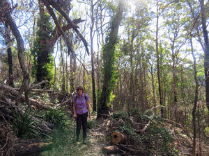
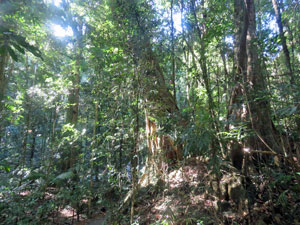
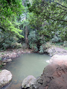
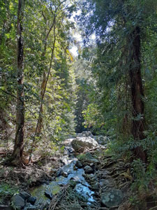
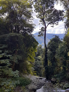
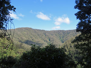
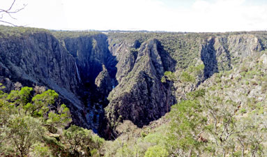
At one stage a fire trail or old-logging track led down to Pholis Gap. Now the forest has reclaimed the route, leaving an overgrown foot-track, with the odd fallen tree or tangled vine adding interest to the walk. This path descended steadily in the cold winter air beneath the shady canopy of the tall rainforest trees. Eventually, blue sky broke through the dense greenery ahead .... we had reached the edge of the Nightcap Range escarpment and parallelled it for a short distance before arriving at Pholis Gap.
|
|
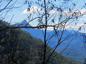
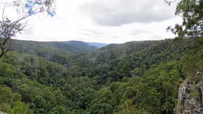
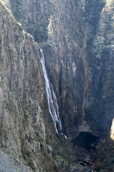
To be honest, it was a little disappointing. The National Parks website promised "spectacular views across to Wollumbin-Mount Warning and the dramatic mountains of the Nightcap escarpment", but the gap is quite overgrown with fragmented views through the vegetation. What was interesting though was the dramatic change in vegetation, with the steep north-facing escarpment slope dominated by drier eucalypt forest and grass trees, a big contrast to the lush rainforest of southern slopes. |
||
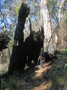 Burnt out remains of a very big tree |
 View across to Mt Jerusalem National Park |
 Sclerophyll habitat on the escarpment |
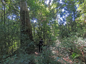
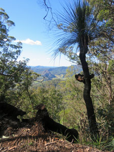
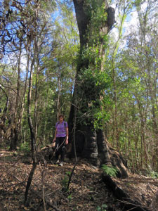
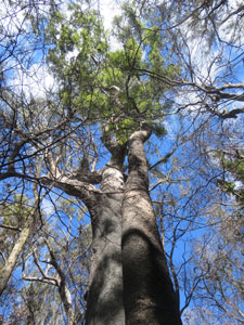
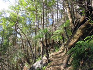
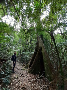
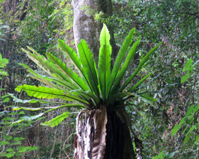
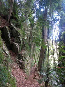
We joined a more well-formed track to follow this escarpment, climbing upwards along its edge towards Mt Nardi. As well as the dramatic vegetational ecotone, the impact of the 2019-20 bushfires had left their mark. They had burnt up the drier north slope, blackening the trunks of the giant blackbutts, scorching grass trees and killing some of smaller rainforest shrubs that encroached on this ecotone. Fortunately though, the fire did not penetrate the rainforest and the track only had to deviate some 20-30m away from the escarpment edge to once again be in the cool, dark shade of these superb trees .... all very fascinating. |
||
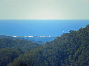 The Pacific Ocean - 30 km away |
 |
 Fire recovery in the escarpment scerophyll forest |
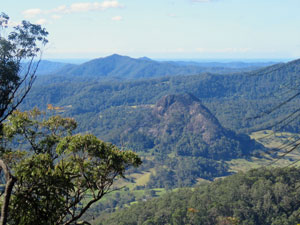
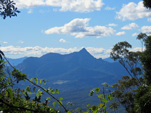
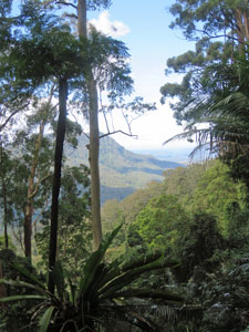
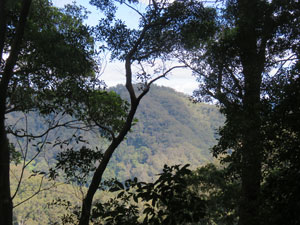
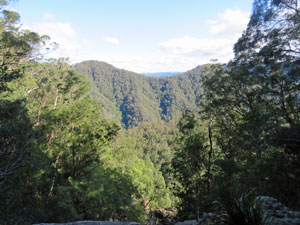
It was interesting to see how the rain forest vegetation can resist fire, but should it be burnt, recovery is difficult whereas the sclerophyll forest burns easily, but recovers quickly. Despite the effects of the fire, there were few open views, but when we found one we stopped ... a good spot for a late lunch, looking out over the forest-clad hills of Mt Jerusalem National Park to the distant Pacific Ocean, some 30 km away. |
||
|
|
|
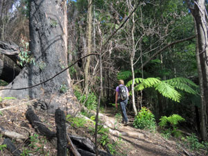
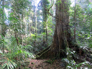
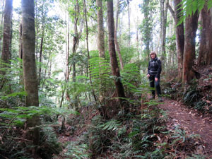
Once we reached the northern end of Mt Nardi, we pressed on to do a short loop of Mt Matheson, jutting out from the range. Again, the vegetation ranged from rainforest to open drier eucalypt forest and back again as slope and aspect changed. The hoped for views over the valley did not eventuate, but the changes in vegetation created the interest. |
||
 Track around the open north slope of Mt Matheson |
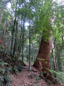
 Buttressed rainforest trees on the south slope of Mt Matheson |
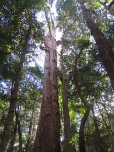
 A rainforest giant |
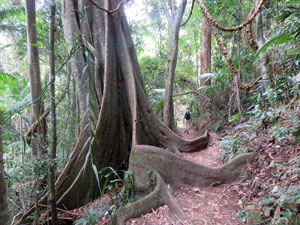
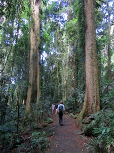
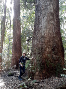
On completing the loop, we followed the track (now part of the Historic Nightcap Track, a bridal trail which joined the Richmond and Tweed Valleys in the 19th century), back through some particularly tall rainforest trees to the carpark at Mt Nardi. From here a short walk down the road brought us back to our car at the Pholis Gap Trackhead. |
||
 |
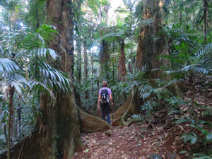 Passing beneath the big trees of Mt Nardi |
 |
We had enjoyed our brief foray into the rainforest .... a daywalk in such dense forest is fine, but if it were a longer walk, we agreed that the open vistas of the coast or alpine mountains are the place to be. |
|
Not quite Queensland |
We left Nimbin greatly enlightened - having foolishly raised the subject of Covid-19 with our accommodation host, we learnt that Covid-19 actually kills less than 0.1% of people affected and its impact is caused by 5G networks that deprive our cells of oxygen. Despite this exceedingly low mortality rate, it is part of a world-wide plot by the eugenics advocates, led by Bill Gates and Big Pharma, to reduce the world's population and control our behaviour, while making a massive profit through tricking everyone on the planet to vaccinate using their toxic products. Next they will be wanting us to vaccinate against all sorts of viral diseases - how could we not have seen this!!!! Nimbin was once a peaceful alternative town, where hippies smoked their pot and disconnected from the world. Was our encounter just an aberration, or has this corner of paradise been overtaken by conspiracy theorists? Increasingly, I find this planet and its inhabitants a mystery. The pandemic though was having its impact on our travels. Our original intention had been to climb Mt Warning, the heart of the great Tweed Volcanic Shield and an isolated sentinel that loomed over the surrounding landscape - from its summit, the dawn first rises on the Australian continent. Unfortunately, its summit, the walking track and the surrounding National Park were closed, apparently due to fears that social distancing could not be maintained on the steep and narrow track and small summit area ..... covid 1, walkers 0. We headed on. |
|
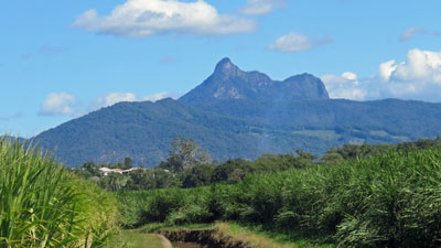 The 1156m peak of Mt Warning (or Wollumbin) |
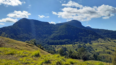 Mt Tenduragan and Springbrook Mountain on the Queensland-NSW border |
Our next shock came at the Queensland border - as fellow Australians caught up in the midst of this Covid-19 pandemic would know, states are shutting their borders to restrict virus transmission. Having come from covid-free Canberra, avoided current disease hotspots on our travels and obtained the appropriate border pass, we thought we would be OK to enter the Sunshine state. But no! We were turned away at the border by the Queensland police (very politely I should add) - apparently driving down a 4-lane motorway that skirted an infection hotspot as we passed the outer suburbs of Sydney, without stopping (or even winding down a window) some 11-days earlier was enough to get us banned from entering. However, with an arbitrary 14-day period since "exposure" in place, we were told that we could enter in three days time. So, here we are in a small apartment just south of the border, holing up for the next three nights waiting to try again. The last time we were blocked at a border was in 1989, when trying to enter West Berlin from East Germany via the "incorrect" autoroute. However, they did let us through after a couple hours of mind games .... and this was perhaps more understandable for in a few months their country would cease to exist. Yet here we were blocked in our own country ..... we live in interesting times. |
|
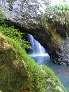
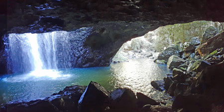
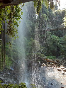
Springbrook National Park - Natural Bridge |
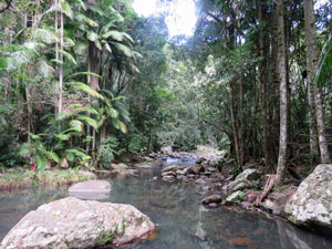
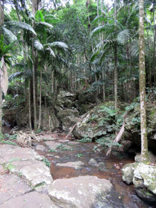
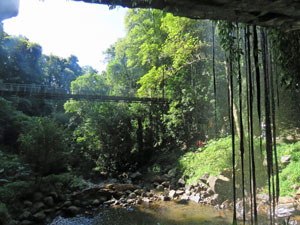
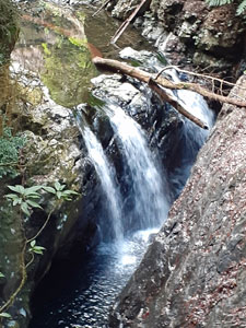
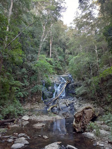
Springbrook National Park lies just over the Queensland border and abuts the rainforest-clad Border Ranges. The jewel of its western flank is a natural feature called Natural Bridge (what else). Here, the clear waters of Cave Creek babble their way beneath the dark Gondwana rain-forest canopy before plunging into a deep circular hole in the basalt rock to flow out the mouth of a cave. |
||
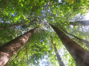
 Rainforest in Springbrook |
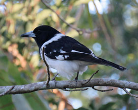
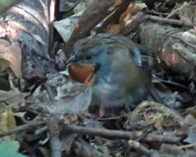 Can you spot the log-runner? |
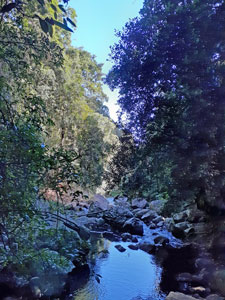
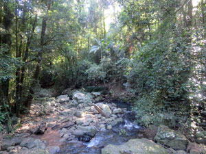 The rocky bed of Cave Creek |
|
A 1 km circuit takes all of this in - short, but the perfect way to appreciate this unique rain-forest landscape and break up a long drive. The images below struggle to do it justice.
|
|
|
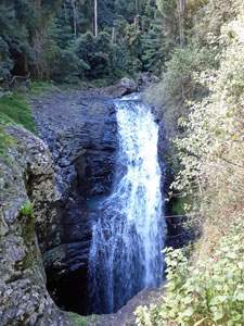
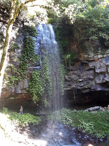
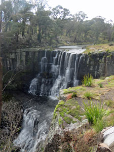
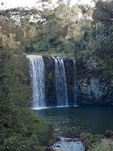
Springbrook National Park - Purling Brook Falls (7.5 km - 230m ascent - 230m descent) |
I have a brother, who lives with his family on the Gold Coast, and one reason for our crossing the border was to catch up with them - just in time for his 60th birthday. While there, he took us to one of his favourite spots - Purling Brook Falls back in the Springbrook National Park. With a straight drop of 106m, these falls are definitely worth a visit. To see them from the top is easy, as there is a viewpoint very close to the start. My brother, however, led us on a longer circuit down into the forested gorge below the falls for a better rain-forest and waterfall experience. |
|
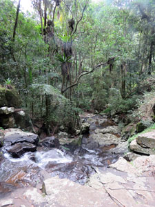
The track led us around the edge of a cliff-wall, with views out over the lush green rain-forest below, to where the gorge opened out into a broader valley that pointed towards the coast. Soon after crossing Camp Creek, where its trickling stream dropped off the cliff-face, we began a zig-zagging descent - rock-face and the trickling Tanninaba Falls on our upside and tall rain-forest trees on the steep slope facing the valley.
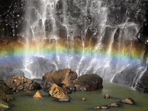
At the bottom of the descent, we reached the cleft of the gorge and the base of the Purling Brook Falls. Here the waters of Purling Brook crashed 106m down the sheer cliff into their plunge pool, where the mist created a mini-rainbow ..... a spectacular sight. We stopped for a while to take it in. |
|
 Forest of the valley floor |
 A particularly impressive set of buttress roots |
 Purling Brook |
Leaving the falls, we continued down the gorge beneath the rain-forest canopy to eventually reach the idyllic setting of Warringa Pool. The scream of a girl jumping into the clear water of the rock pool convinced us it was probably too cold for a swim, so we settled for the coffee and cake that my brother pulled out of his backpack. |
||
 Camp Creek |
 Warringa Pool |
 Heading back up from the pools |
Then it was time to retrace our steps back to the Falls, and continue on ... over the bridge that crossed Purling Brook, a steady climb up the opposite slope of the valley, a quick last view at the top of the waterfall over the cliff-line and vast stretch of rainforest, and back to the picnic tables at the start. |
||
 |
 The sheer cliffs of Purling Brook Falls |
|
Here my brother reached into his backpack one more time to produce a picnic lunch and chilled bottle of wine to celebrate an enjoyable couple of hours exploring the landscape of Springbrook .... the catering on this walk was excellent. Thanks, Kym, and happy 60th birthday. |
|
Short Walks on the Sunshine Coast |
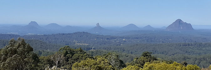
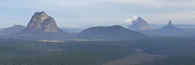
My sister and her husband live on the Sunshine Coast, so after leaving my brother, we continued on northwards to visit them. This is the land of The Glasshouse Mountains and their curious profiles have attracted many a photographer. Herewith a couple of views from different angles.
|
|
Like on the Gold Coast, we had a pleasant time catching up, playing cards and going on a few short walks in local rainforest areas and a visit to the Mary Cairncross Rainforest Discovery Centre. It was a pleasant stay - thanks Helen and Wayne.
|
 Serenity Falls at Buderim |
It was time to head south again - we had one more part of the Gondwana Rainforest World Heritage Area to visit - Dorrigo National Park and that was back in northern New South Wales, a day's drive away - a cold, wet day in fact once we left the Sunshine Coast. Thankfully the forecast for our walking days was much better. |
|
Dorrigo National Park - Wonga Walk (6.5 km - 230m ascent - 230m descent) |
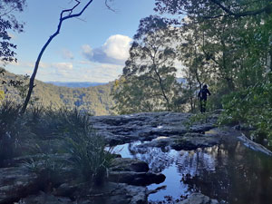
Dorrigo National Park contains some of the best sub-tropical rainforest in Australia and, to show it off, the National Park has built a Rain Forest Centre and created a superb sealed track through the forest. Some may turn their noses up at a sealed track, but it does enable people of differing abilities to experience the serenity and ambience of the forest. These Gondwana rainforests are World Heritage-listed. The Dorrigo Rainforest Centre sits on the edge of an escarpment, so the first thing to do on this walk is to wander out some 70m on a wooden walkway that heads into and above the forest canopy, as the escarpment edge drops quickly away beneath. From the platform at the end, you can look down onto the dense green canopy that hides the walking terrain, or across the forest-clad slopes and valley to the distant flat blue of the Pacific Ocean - a superb panorama. |
||
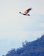 A wedge-tailed eagle soars in the distance |
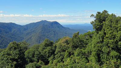 View of Dorrigo National Park from above the canopy |
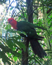 King parrot in the canopy |
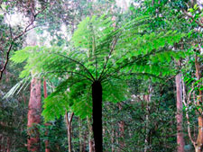
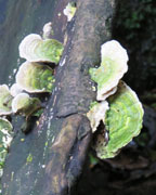
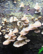
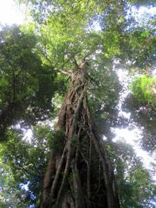
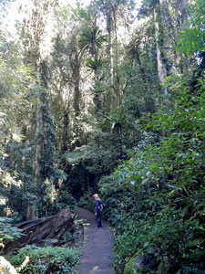
The track is a 6.5km loop known as the Wonga Walk, named for the ubiqitous woody wonga vines that drape down from the tall trees or scramble upwards in search of the light. To reach it from the Rainforest Centre, we first followed the Lyrebird Track, down a wooden ramp that took us to the damp forest floor beneath the edge of the escarpment. After the heavy rains of yesterday, the air on the forest floor was richly dank and cool. The track wended its way around, in the shade of the tall trees with their dense leaf canopies 20-30m above our heads. A tangle of woody vines connected canopy and forest floor, where mosses and fungi colonised the fallen trunks and the occasional brush turkey scratched through the rich layer of leaf litter. |
|||
 Mid-canopy rainforest view |
 |
 |
 Vines and epiphytes of the forest |
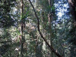
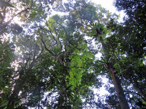
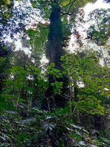
Quickly, we reached the junction of the Wonga Loop and headed off in an anti-clockwise direction. This kept us higher on the escarpment slope, passing beneath the forest giants, some reaching 50m in height beyond the green mantle of the canopy ....the battle for light is relentless. Looking up we could admire the play of light and shade dappling their leaves and the magnificent birds-nest ferns clinging to their trunks. Each trunk seemed to create its own little ecosystem, with mosses, ferns and vines, epiphytes and fungi finding a home on them. |
|
|
 Boardwalk on the Wonga Loop |
 Looking up into the canopy |
|
 A 50m high tree enjoys the sunlight high above the canopy |
On reaching a deep gully, the sealed track became a raised boardwalk, taking us across the gully at mid-canopy height, with great views down to the forest floor below, where ferns, palms and small shrubs competed for the demi-light that reached it. The calls of the forest birds filtered down from the canopy, while the occasional brush turkey or log-hopper skulked through the undergrowth. |
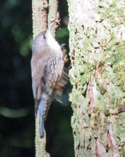 Tree-creeper tree creeping |
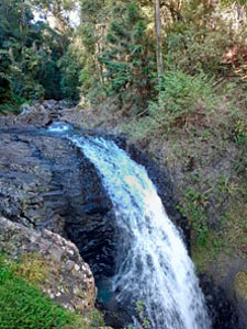
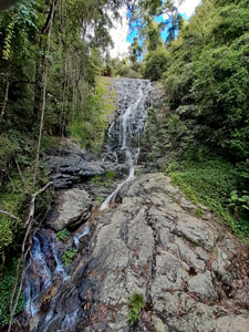
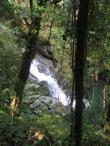
The track now began to descend rapidly beneath the rain-forest giants to reach the deep gully of Crystal Shower Falls. The falls are not very high (35m), but the setting is spectacular and just enough sun was getting through the gaps to show why they were named Crystal Shower. A suspension bridge crossed the creek in front of the falls, giving superb views and, on its far side, a side-track enabled us to get in behind the waterfall and enjoy the view through the veil of water droplets. |
||
|
Leaving the falls, we climbed a little to reach a drier spur leading out from the escarpment. Here, the forest was more open and towering eucalypts mixed in with the rainforest trees. Glimpses began to appear through the trees out over the valley, culminating with a superb view at Hardwoods Lookout.
|
 The falls from behind
|
|
From the lookout, the track wound its way down through a break in the escarpment. Once more we were in the cooler, moister rainforest, enveloped in its dark greenery. As we descended, a muffled roar of water announced the Tristania Falls. We were soon admiring them, water tumbling down a polished rock slope, from a small bridge that crossed 30m below. Beyond the bridge, the creek tumbled over another rocky edge to disappear into the valley. |
|
|
 |
 |
||
From here, the track climbed gradually back up, beneath giant red cedar and tallowwood, sassafras and coachwood, around the the wide buttress roots of carabeen and past the tangled knots of strangler figs ... a rainforest feast. A final short climb brought us back to the junction with the Lyrebird Track, which led us back to the Rainforest Centre and the end of the walk. |
|||
 A gisnt strangler fig |
 On the Wonga Loop |
 Forest giant amongst the stinging trees |
 Trying to see the top of the canopy |
It had been thoroughly enjoyable and changed my attitude a bit to walking in a rainforest - yes, it was enclosed and there were few grand vistas, but the diversity of the forest, the scale of its trees and the superb waterfalls made the Wonga Walk a great introduction to the world of the sub-tropical rainforest.. |
|
Dorrigo National Park -A Walk in the Never Never (11 km - 430m ascent - 430m descent) |
Deep in the heart of Dorrigo National Park is the Never Never Picnic Area. It is the starting point for several lesser-used tracks that, when combined can give a more complete picture of the park and its vegetation. We chose to put together sections of the Rosewood Creek, Red Cedar Falls and Blackbutt tracks to complete our brief exploration of Dorrigo National Park. |
|
It was a much cooler day (maximum of 13°C) as we set out from the Never Never Picnic area, though I suspect the rainforest would have been cool regardless of outside air temperature. Heading off down the Rosewood Creek Track in a clockwise direction, we were quickly in the deep shade of coachwood and sassafras, following a narrow, but well-formed foot track beneath the dense canopy. |
||
 |
 |
 On the Rosewood Creek Track |
|
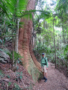
The track wound its way around the slope, crossing several fern-filled gullies, where water from the recent rains trickled down their steep rocky courses towards the larger creeks below. We soon reached the deep and steep-walled valley of Rosewood Creek and turned south-east to follow it high up on its slope. Here the giant trees - beech, tallowwood, blackbutt and cedar - punched through the canopy, 30m above us, their trunks a home for magnificent birds nest ferns and even the odd staghorn. |
|||
 Another set of impressive buttress roots |
 Cascades on Rosewood Creek |
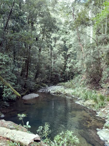
 The clear waters of Rosewood Creek |
 Traversing the steep valley slope |
Apart from the occasional twittering of forest birds, the landscape was silent. It was a time to walk along quietly and just appreciate the tranquillity of the rainforest. |
||
|
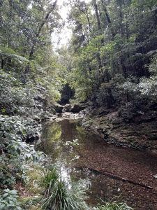
As the track slowly descended the steep valley walls, the constant babbling of Rosewood Creek below us dissipated the silence. At a couple of spots, we took a short, but slippery sidepath down to the creek to get a closer look at the deep pools and short rocky clefts that alternated as the creek flowed down the valley.
|
|
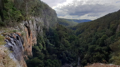
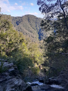
At Coachwood Falls, the creek tumbled several metres through a gap in the volcanic rock of the escarpment. From here, it began a steeper and rougher decent towards the edge of the escarpment, while the track once again climbed up the heavily timbered slopes back into the silence of the forest. We soon reached the junction of the Red Cedar Falls track and turned to take it. It was the highlight of the walk ..... the track descending 200m, at first via a series of long zig-zags, then steeply down a set of stone steps that breached the rock wall of the escarpment. Through the gaps in the vegetation, we could see across to the green-clad slopes of the far side of this deep valley. |
||
 |
 Birds nest ferns and mountain views |
 |
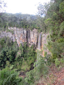
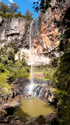
The roar of the falls was now reaching us and a few more short, steep zig-zags brought us to its base. What a spectacle ... a silvery horsetail falling 58m down the rock face of the escarpment into a clear green plunge pool. Red Cedar Falls is the jewel in the crown of Dorrigo National Park and we were the only ones there (Over 95% of people visiting Dorrigo National Park will do one of the walks from the Rainforest Centre, but relatively very few walk from Never Never .... it makes for a much more authentic experience). We stopped for our lunchbreak, to sit and take the time to enjoy the spectacle of these falls deep in the Gondwana rainforest. |
|
|
 Descending the escarpment wall |
 Relaxing at Red Cedar Falls |
|

Lunch over, we paid the price of the visit, with a long and steady climb back up to the track junction. Here we turned left, to follow the much gentler slope of the Rosewood Creek track to its junction with the Blackbutt Track. Here we again turned left to follow the Blackbutt Track through a drier and more open landscape as it headed out along an escarpment spur. Below us, Sassafras Creek was babbling away, as it formed a series of rocky cascades tumbling down towards the escarpment edge. |
|||
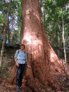
 Nello and the very big tree |
 Another view towards the canopy |
 On the Blackbutt Track |
 More open forest on the drier spur |
|
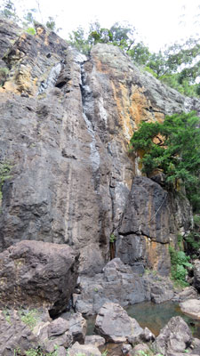
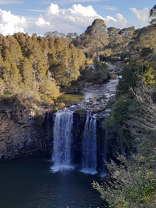
Reaching the end of spur, the track once again zig-zagged steeply down to meet the creek at the top of Casuarina Falls. Here, the creek tumbled 50m over the escarpment edge in a series of drops to the valley way below. The opening at the falls also offered superb views across the forest-clad mountain slopes. It was worth the side-trip.
|
|
Retracing our steps, we now continued on the Blackbutt Track to complete the circuit and return to Never Never Picnic Area. The landscape was flatter and the forest dense, but the canopy seemed lower and there were fewer really big trees. The massive stumps with slots cut into their flanks offered a part explanation ..... reminders of the 19th century era when woodcutters came here to seek tallowwood, coachwood and cedar. What magnificent specimens might they have been now, had they not been felled for their timber. |
||
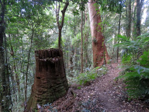 A series of enormous stumps ..... |
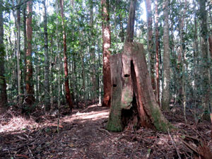 .... all that is left from the activities .... |
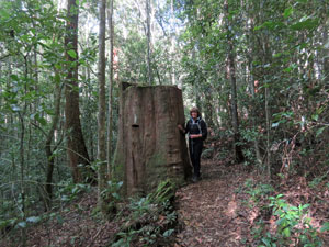 .... of 19th century loggers |
Thus ended our foray into the Never Never - a land of lush forest, giant trees and magnificent waterfalls. Dorrigo National Park is definitely a very special place. |
|
|
