
| Transylvanian Walking Circuit (part 1) |

Getting There - a day in Bucharest |
We had finished our cycle tour in Kladovo, Serbia, and the next adventure lay deep in Romania - it would be a tiring trip. A new cross-border ferry started up in June from Kladovo across the Danube to Drobeta-Turnu-Severin in Romania. It was a quick way of getting back in to the EU region and, being a short walk from our hotel in Kladovo and a short walk from the Romanian river port to the train station, our journey started out well. We had two hours to wait in Drobeta-Turnu-Severin, so wandered in to the centre to get some lei from the ATM. The river's edge of this large city was heavily industrialised, but the centre was a pleasant surprise, with broad boulevards, nice parks and attractive old buildings. |
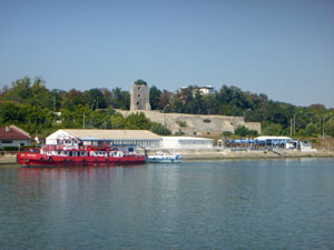 Romanian shore-line of the Danube |
|
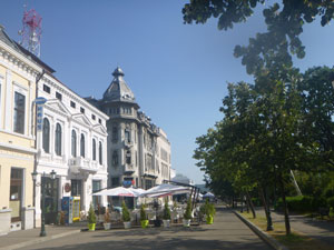 Streetscapes ....... |
 ....parklands, and ...... |
 churches of Drobeta-Turnu-Severin |
Finally, our train arrived (continuing our experience of European trains never being on time) and we boarded for the long and slow journey across the Romanian countryside and villages (all of which seemed to require the train to slow down to 25 kph as it passed through) to Bucharest, finally arriving at midnight to tumble in to our hotel bed and quickly fall asleep. |
|
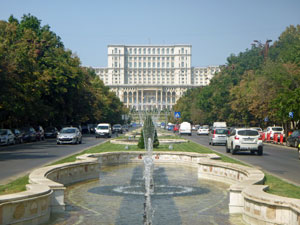
 Ceaucescu's folly - the 1984 Parliamentary Palace |
 Dambovita River Canal in Bucharest |
The next morning, after a bit of a sleep in, we set out to take the metro and explore a little bit of Bucharest - starting with the colossal Parliamentary Palace, second largest building in the world and described as a monument to totalitarian kitsch. It was commissioned by the former communist dictator, Nicolae Ceaucescu in 1984, Ceaucescu, of course did not live to see its completion, being executed after the 1989 revolution (a revolution that the fair Nello and I watched live-streamed on television while living in France at the time - quite an amazing period). |
||
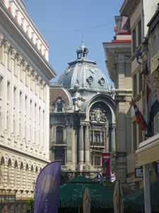
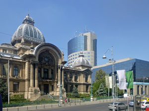 Modenr and historic Bucharest juxtaposed |
 in the older quarter of the city |
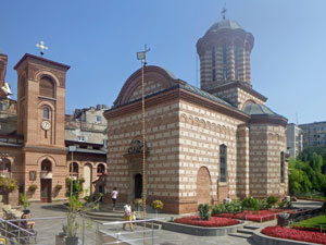 Biserica Sfântul Anton (built in 1559) |
With a complement of similarly massive, neoclassical government buildings lining the large boulevards facing the parliament, the whole setting is strangely aesthetic. From the parliament, we wandered down the broad, shady and fountain-lined Boulevardul Unirii to reach the historical centre of the city, with its more pleasing mix of 19th century-French style buildings and orthodox churches. |
||
 |
|
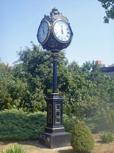 |
This led us on to Parcul Cismigiu, one of several pleasant parks in the city. Its shady trees and lake were a nice way to end our short visit, as the temperature was again reaching the mid-30s. Time to head back to the hotel for a beer and to meet the walking company rep and pick up our guide notes and maps for our self-guided walking circuit in Transylvania. |
|
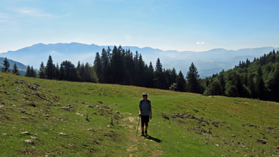
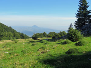
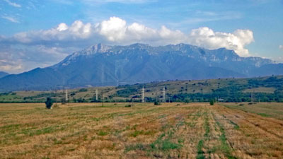 The transition from flat farmlands to mountains |
 First look at the Eastern Carpathian Mountains |
The following morning we caught another slow train north, at first across the dry plains and then climbing slowly up into the green forest-clad hills and limestone-capped peaks of the Eastern Carpathian Mountains to the medieval city of Brasov. We were now well into Transylvania and, with five hours between connections, we headed down to wander the medieval streets of Old Brasov - a bonus was to be able to stop and listen to the final rehearsals for an open air concert at the Cerbul de Aur Music Festival. It was as good as the real thing. Finally, it was time to catch an even slower train to the small town of Zarnesti, gateway to the Piatra Craiulul Mountains. It was from here that our 7-day walk would begin. |
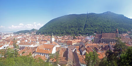 The medieval city of Brasov |
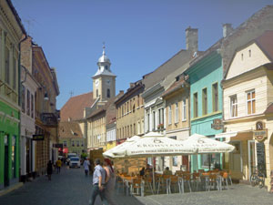 Street in Brasov |
 The Casa Sfatului (Council House) first built in 1503 |
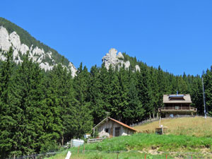
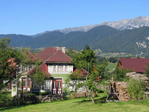
 View from our guesthouse in Zarnesti |
|

Day 1 - Zarnesti to Magura (17.5 km - 1010m ascent -760m descent) |
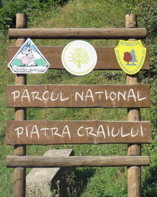
I looked out of the bedroom window of our pensiunea in Zarnesti - out over the red tiled roof-tops, the green forest-clad slopes of the Piatra Craiulul massif rose steeply to meet the clear blue sky. That is where we were headed and the weather was perfect for a walk in the mountains. We set out quickly from the pensiunea in the cool morning air, stopping at the corner shop to buy some energy food for the walk, then along the streets of Zarnesti and into the National Park. |
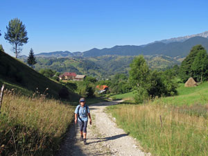
 The route out of Zarnesti ...... |
 ..... and into the countryside |
 |
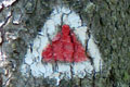
The shaded gravel road led us quickly into a deep V-shaped valley, a dense forest of deciduous trees and conifers clinging to its sides. On reaching the Botorog Spring, we had a few mouthfuls of its delicious icy mountain water and turned northwards to follow a yellow-marked foot track into the forest and steeply up the slope. |
||
At first, we followed the gully of a stream tumbling down, then traversed eastwards to climb up a long and steep spur. The humidity was high beneath the forest canopy and we were soon working up a serious sweat, as we pushed higher on the winding and, sometimes braided, track (I think Romanians must like their short-cuts). |
||
 A quick drink at the Botorog Spring |
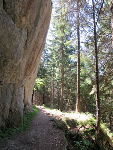
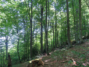
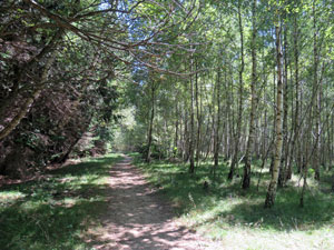
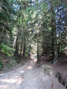
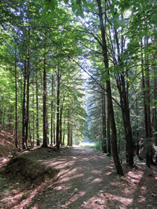 Path into the Transylvanian forest |
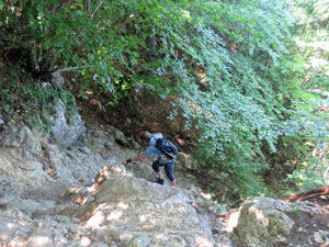
 Climbing a steep spur of Piatra Craiulul |
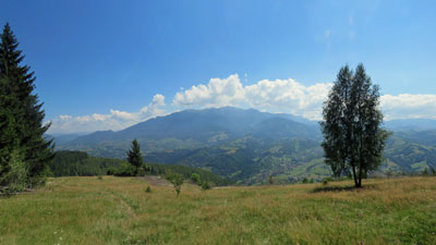
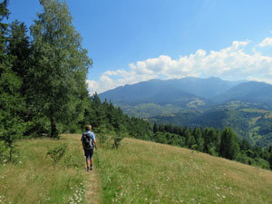
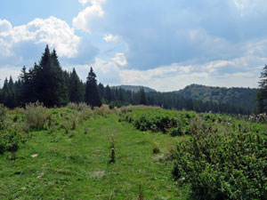
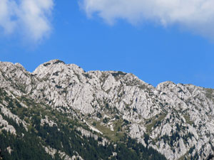
After gaining several hundred metres of elevation, the track broke out into a large pasture. Magnificent views opened up of the limestone topped ridge-line of the Piatra Craiulul ahead, and behind over the tree-tops to the hazy blue silhouette of the Bucegi Mountains. |
||
 |
 Crossing a high mountain pasture |
 |
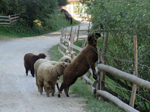
The tinkling of bells marked a flock of long-tailed sheep - we passed through them under the watchful eyes of a pair of Carpathian sheep dogs. With the shepherd sitting under a tree nearby, they were happy to just watch us pass. |
||
 Here Romanian shepherds still tend their flocks .... |
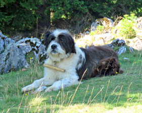 ... helped by the big Mioritic sheepdogs |
 Cabana Curmutura |
Soon we were back in the forest, now dominated by tall spruce trees beneath the limestone-topped ridge. The route here gradually climbed across the slope beneath the cool upper forest, with occasional glimpses of pastures below. Then, suddenly, we reached a fence and small wooden gate - we had arrived at Cabana Curmatura, hidden in the forest below the limestone tops, above a small grassy clearing dotted with camping tents. This was a place to stay or just visit and have a meal - we enjoyed some soup and a slice of sweet sheep cheese pie. |
||
|
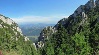
The ridge-line was another 150m above the chalet, so while the fair Nello basked in the mountain sunshine, I made a quick dash up the steep, zig-zagging, path in the pine forest to reach Saua Crapaturii, an open rocky slab with beautiful views through a jagged limestone gap of the plains to the east. It was worth the hot and sweaty side-trip.
|
|

Curmatura was a pleasant place to just hang out, but eventually we had to leave, descending quickly along a grassy track between groves of spruce and fir. The track continued its descent, sidling alongside a broad pasture, where bell-tinkling cattle grazed beneath the limestone walls of the ridges - a bucolic setting. |
||||
 |
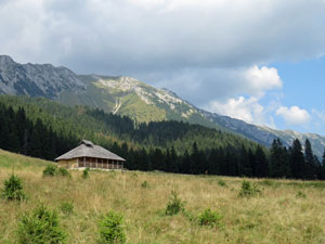
 Shepherd's hut below the limestone cliffs |
 |
||
We then re-entered the forest to continue the long descent, following a babbling brook, as the valley walls around us became increasingly steep and stream dropped away beneath the track. Suddenly, we reached the edge of a limestone cliff and found ourselves peering into the Zarnesti Gorge. |
|||
 Descending through the high meadows .... |
 |
 |
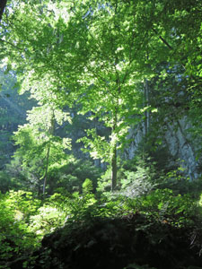
 .... and the tall conifer forest |
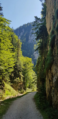
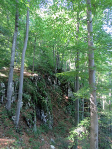
We dropped down to the wide gravel road on the floor of the gorge and followed it through in the shade of the precipitous walls as a gentle cool breeze funnelled through. Zarnesti is a magnificent gorge - 200m high sheer limestone walls, narrow gaps, sun-dappled leaves - it was a lovely 45 minute stroll to its mouth. |
|||
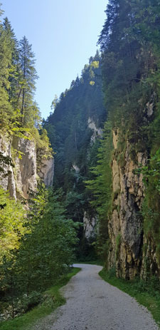 |
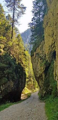 The beautiful vertical landscapes..... |
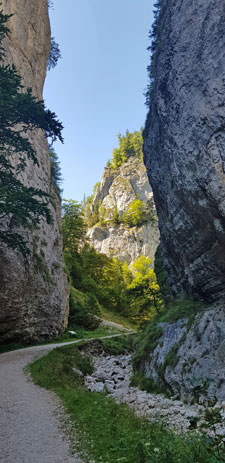 ..... of Zarnesti Gorge |
 |
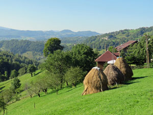
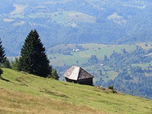
 Isolated farmhouse near Magura |
We were now nearing our destination - the village of Magura - but sadly that was now 120m above us on a neighbouring plateau. Fortunately, I spotted a short-cut on the map and we made one last climb, steadily up through the forest and into the open pastures and scattered houses above. |
 Laneway bewtween the fields of Magura |
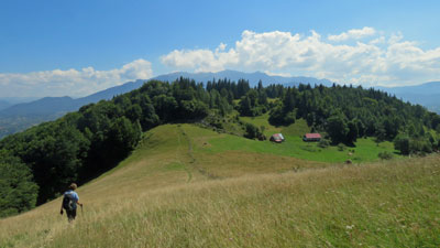
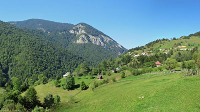 The grassy slopes of Magura backed by a ridge of Piatra Craiulul |
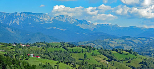
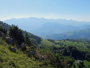
 Panorama of Magura and the distant Bucegi Mountains |
|
One final climb up a deeply eroded laneway brought us to our Magura pensiunea, sitting on the ridge with picture-postcard views over the green pastures, forests and rolling hills to the distant Bucegi Mountains. What a great place for an end-of-walk beer on the deck - let's drink a toast to Transylvania.
|

|
Day 2 - Magura to Bran (11.5 km - 310m ascent - 530m descent) |
The slight mistiness of early morning had cleared by the time we set for our second walk - a shorter one to the nearby town of Bran, famed for its castle (its castle being famed for its association with Dracula). We wandered slowly down the winding gravel road that led past the fruit trees, haystacks, sheep, dogs and horses, scattered houses and the village church of Magura - the village has spread itself out across the green slopes and valleys of this landscape. After a while, we turned off onto a side road and started heading uphill towards a long ridge-line capped with a series of small limestone knobs. The road veered eastwards and we headed north-west along a footpath that wound up the steep grass-covered slope below the limestone cap of Prislopului Peak. |
 View to the west over Magura village |
|
|
|

Following our guide notes and turning east behind a small mountain hut, we made a slight navigational error - the route apparently continued east in front of the the peak, but we missed that and veered north west again, climbing up through the scrubby higher slopes to reach a broad and serene pasture. |
||||
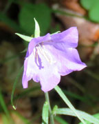
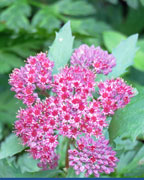
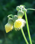
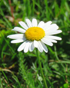
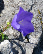
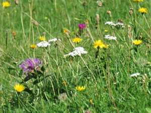 Wildflowers in a Transylvanian meadow |
Even though we had only climbed 250m, our shirts were soaked in perspiration - finding a spot shaded by the limestone rocks above, we took them off to dry in the morning sun and spent the next 30 minutes soaking up the ambience of this place - lovely views over the Zarnesti Gorge to the white-topped ridgeline of Piatra Craiulul to the west, views out to the eastern plains above the mole hills that dotted the pasture, and an abundance of wildflowers in a mountain meadow ungrazed by sheep.
|
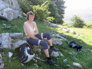 Yes, it was a hot climb |
||
 |
 |
 |
 |
|
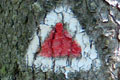
Once our shirts had dried a bit, we headed on, passing an old wooden hut to pick up the red/white trail markers. These led us through beautiful beech forest on the northern slope beneath the limestone walls of Galbinarea Peak. Once around the cliffs, we emerged onto a grassy saddle that separated it from the next limestone knob of Magura Mare and which offered panoramic views of the undulating lands to the south. We were back on track .... briefly. |
||
|
|
|


A new signpost was there, but the three different signs lay unattached at its base. Here, we took the left fork and, instead of climbing over Magura Mare, we again skirted it to the north, beneath the limestone walls in the shade of some lovely beech forest. The only downside to this "detour" was a short steep climb up a gap in the rock wall to reach the red/white marked route again. We decided to stick to this for the rest of the walk. |
||
 Beneath the limestone cliff of Galbinarea |
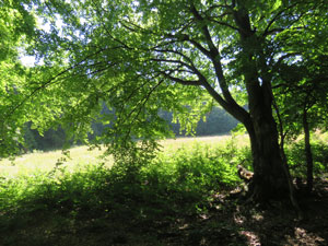
 Birch trees on the steep northern face of Magura Mare |
 The play of lght and shade in the forest |
The climbing was now largely over and the route led us down through the sun-dappled beech forest, past a series of grassy clearings offering superb views over the plains and towards the Bucegi Mountains, into dense fir forest and along the birch fringed edges of fir forest and grassland. |
|
 Crossing the open meadows above Bran |
 Views toward the Bucegi Mountains |
 The fringe of forest an meadow |
 Ecotone between spruce and birch forest |
 |
|
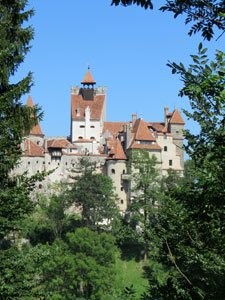
Gradually the ridge narrowed into a steep spur, offering a slow descent towards the town of Bran on an ever-steepening track with little opportunity to zig or zag. The hum of traffic rose up from below, warning we were near the end of our walk. Suddenly, we spilled out onto a grassy flat, looking straight ahead at the many-turreted imposing shape of 14th century Bran Castle. It was certainly a spectacular way to finish the walk.
|
|


|
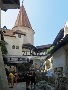
The castle, however, has become a victim of its own fame - thousands of tourists now flock to Bran each day by bus and car to visit it, lured by its association with Dracula more than by its imposing architecture (an association which is completely fictitious, but why let fact spoil a good story) and the town is noisy and crowded. Nonetheless, we were here now, so we bought our tickets and joined the 45 minute long queue to snake our way through the labyrinthine interior of the castle. The one good thing was that we had arrived in the midst of the Bran Jazz Festival, so after our experience of mass tourism, we could enjoy a beer in the more peaceful castle gardens to the rippling rhythms of some soft jazz. |
|
Then it was back out into the noisy, car-cluttered, people-filled streets of Bran. How we would much prefer the irenic green hills of Magura ..... as if on queue, our taxi arrived and drove us back to our pensiunea. It was once again time to enjoy the evening light, and soak up the postcard ambience of this lovely and mind-soothing part of Transylvania. |
||

|
Day 3 - Magura to Ciocanu (18 km - 560m ascent - 390m descent) |
It was time to say farewell to our friendly pensiunea hosts and their old sheepdog, as, once again, our walk started with clear blue skies under a warm morning sun. This time we turned west, heading out of the village along a gravel road. Magura, however, is difficult to escape from and 30 minutes later, we were still wandering past the scattered houses, as we climbed gradually upwards adjacent to the forest. |
||
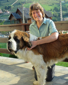 The fair Nello and friend |
Behind us, the limestone caps of Galbinarea and its neighbours receded into the distance, as the sound of hymn-singing drifted up from the white-walled church below .... hmmm, it must be Sunday.
|
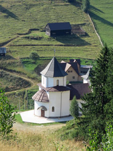 Looking down on the village church |
|
After a while, the gravel road turned into the forest and began to climb steadily up a small valley to finally bring us out onto a large, rolling pasture. Here, cattle grazed lazily on the lush grass, while between a gap, the rugged white-topped ridge of the Piatra Craiulul massif gleamed in the sunlight - another scene of bucolic bliss. |
|
 Farmhouse above the Zarnesti Gorge |
 The road to Saua Joaca |
|
The narrow road pushed on to continue climbing up through a further grove of spruce to reach the heights of Saua Joaca, a grassy saddle from where we could admire the full length of the Piatra Craiulul massif, and its central peak of La Om at 2238m. As we were taking in the views, the clouds that had slowly been drifting in seemed to be also slowly taking on a greyer hue. |
||
 A fellow traveller |
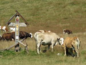 Cattle on the high meadow |
|


|
From the saddle, the road dropped down into the forested valley at the base of these mountains to reach the multi-track junction known as La Table. From here, we turned south to follow a route through a high undulating valley that alternated between open meadows and forest.
|
|

 Heading towards La Table
 A few wildflowers |
 |
 |
 A patch of thistle-infested farmland |
While the high mountains continued to impose themselves, something unexpected began to creep in. The vegetation took on a more scrubby appearance - trees had been lopped or knocked down, signs of grazing damage became more obvious and the track had been churned up by heavy machinery or cattle. |
|||
The pristine beauty that we had come to expect of Transylvania seemed to have evaporated in this area, though scattered wildflowers still added a touch of colour. |
||
 Shepherd's hut on Poiana Grind meadow |
 The 2228m summit of La Om |
 Poiana Lespez meadow |
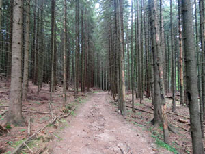
Our undulating route took us past the mountains meadows of Poiana Grind, Poiana Lespez and Poiana Funduri, with their sheepfolds and shepherds' huts, before finally entering a tall fir forest to begin the long descent from this high valley system. At first, even the forest seemed tainted and grey, with tall bare trunks and an absence of ground cover, though as we moved further out onto this very narrow spur, it regained some of its diversity and charm. |
||
 |
 View over the Transylvanina forest to the blue-faded mountains beyond |
 |
|
The route, however, as seems typical of spurs here, led us on a rocky and ever-steeper descent along a narrow crest, before spilling us out onto a grassy flat, filled with picnicking Romanian families - music playing, barbecues smoking and lots of lively chatter and laughter .... it definitely must be Sunday. It was also the site of the mountain chalet, Cabana Brusteret, so we were able to have a cup of coffee after eating our lunch by the edge of a tinkling creek and allowing our descent-jellied knees to recover.
Such a recovery was needed, for only a few hundred metres on, we had to regain much of that lost elevation with a very steep climb up the opposite flank, softly crunching the dried brown leaves of the lovely beech forest about us. The peals of thunder that began to roll regularly across the darkening sky hurried us on. |
|
We were heading for the village of Ciocanu on the plateau above and our next night's pensiunea. After a short wander through fields, past traditional houses, along narrow dirt lanes and finally the asphalt of the main street, we arrived. Twenty minutes later, while enjoying our traditional post-walk beer on the terrace, so did the thunderstorm - it was a ripper and we felt very happy to have beaten it in. However, from the weather forecast, tomorrow we may not be so lucky. |
||


|


